
Koala Survey Finds Gliders
Given historical Koala records in what seems to be relatively abundant habitat in the Pillar Valley, it has long been an intriguing question as to whether there are still Koala present in the area? Records are scant and mostly relatively old. Yet, there are some as recent as 2020! The limited presence of humans in the area could have inhibited even casual observations of this secretive species. And until quite recently, Koalas have been notoriously hard to find, even with dedicated observers involved. Searching for identifiable scats at the base of possible habitat trees is tough going.
However, new techniques using thermal cameras on drones to survey for Koalas are proving very effective in large landscapes and increasing the odds of effectively answering such questions. At the same time, recently released potential Koala habitat mapping (based on relative densities of preferred Koala feed trees in vegetation communities) in combination with local knowledge and the use of GIS analysis has helped to better target key areas to survey.
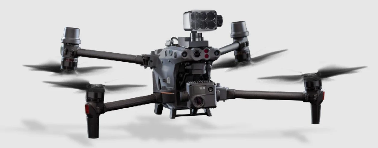
DJI Matrice 30T model used by SMT Ecology
So Corymbia Biodiversity Project worked with a range of Koala focused stakeholders from within the Clarence Koala Working Group to initiate a pilot study of potential Koala habitat in the Pillar Valley and see if we could get an answer. Several parties helped to finance the project, including Clarence Valley Council, The NSW Koala Strategy, The Clarence Valley Koala Working Group, and Corymbia Biodiversity Project.
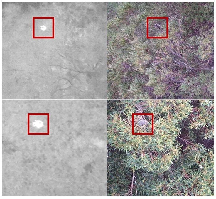
Examples of remotely piloted aircraft system (RPAS) detected koala (Phascolarctos cinereus) thermal signatures validated against 4K visual footage (from Beranek et al 2021).
The pilot study aim was to trial whether a sample of the most likely mapped Koala habitat showed any signs of Koala presence using currently accepted thermal drone survey techniques.
We selected and mapped out flight paths over 1000 Hectares of potential habitat on private lands, with the agreement of 15 different landholders. There was no ground truthing of this vegetation, or of its condition prior to the survey. However, the method used was the same as that used in recent work undertaken by Clarence Valley Council in other parts of the Local Government Area which returned very useful information.
The work was undertaken in late Spring 2025 over 10 nights by an experienced drone pilot from SMT Ecology who almost exclusively operates thermal drones focused on Koala. Drones fly key areas of likely habitat using a ‘lawnmower’ pattern in roughly 50 Ha chunks.
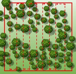
Lawnmower pattern (from Witt et. al. 2020).
Unfortunately no Koalas were detected during the survey. There could be multiple reasons for this, including:
past and ongoing presence of pest predators;
fire history;
history of land use practices;
past and present lantana infestation;
possible historic culling of Koalas in the area; and/or
the available habitat, which is dispersed, fragmented and variable in quality, is just not capable of sustaining viable populations of Koalas and they have now disappeared locally.
While this is a disappointing and inconclusive result, this work provides useful information on the subject, noting there is much more potential habitat that was not surveyed including in State Forest, Crown Land and National Park. Sporadic Koala records in the area are still meaningful and intriguing, and the implications of this work will be further considered.
But it is worth noting that several other significant species were detected at some sites, including:
Yellow-bellied Glider (Petaurus australis)
Southern Greater Glider (Petauroides volans)
Squirrel Glider (Petaurus norfolcensis)
Sugar Glider (Petaurus breviceps
Rufous Bettong (Aepyprymnus rufescens)
These species are listed at state and/or commonwealth levels as threatened species. As such, we’ll take this to be a positive result.
Check out our video highlights from the survey work.
We wish to thank the contributing stakeholders and the landholders that were so helpful in allowing access for this important pilot study.
References
Witt RR, Beranek CT, Howell LG, Ryan SA, Clulow J, Jordan NR, et al. (2020) Real-time drone derived thermal imagery outperforms traditional survey methods for an arboreal forest mammal. PLoS ONE 15(11): e0242204. https://doi. org/10.1371/journal.pone.0242204
Chad T. Beranek, Adam Roff, Bob Denholm, Lachlan G. Howell and Ryan R. Witt, (2021). ‘Trialling a real-time drone detection and validation protocol for the koala (Phascolarctos cinereus).’ Australian Mammalogy, 2021, 43, 260–264. https://doi.org/10.1071/AM20043